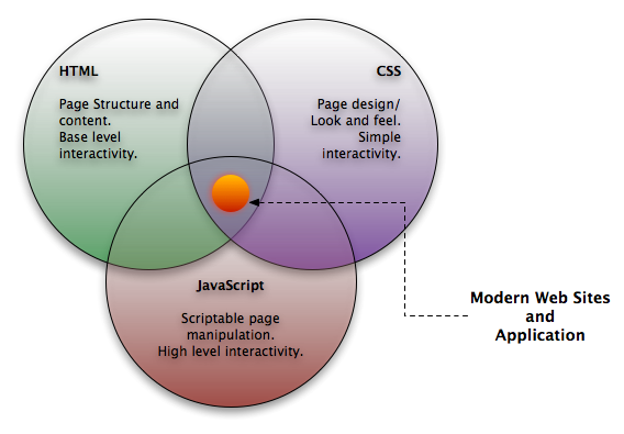
ArcGIS for Server technology (ESRI) is used as a map server providing map services. The links to map services were included in a source code of the application. The basic concept of the applicatio was created by the combination of HTML - CSS - JS.
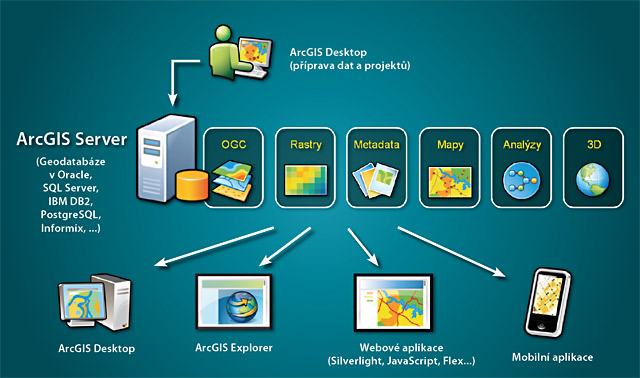
ArcGIS for Server provides tools for management of geographical data based on ArcGIS geodatabase module. Map sources may be published in a form of 2D or 3D map services. These services enable visualization of geographical data in various client applications (desktop, mobile, web). ArcGIS Server offers integrated administration and optimization tools that allow simple configuration of the system to provide high performance to the end user.